TRAILS

View of reservoir from CofferDam Trail

SUPPORT THE TRAILS

Whether you love the Red Trail, West Side Hiking Trail, or ADA paths, Eagle Creek Park’s Trail Crew is responsible for maintaining them.

Donations to the Trail Fund are used exclusively for trail maintenance and can only be invested in the trails at Eagle Creek Park.

The Eagle Creek Park Foundation oversees and ensures all funds are dedicated solely to trail upkeep or expansion.


Learn More > 

Indy Parks and Recreation logo featuring a leaf and colorful icons representing outdoor activities and community engagement.

In partnership with Indy Parks

For Eagle Creek programs, please visit this Indy Parks page.

Plan your adventure

TRAIL SAFETY

Illustration of a modern car with a sleek design, featuring black and teal colors, suitable for automotive-related content.

NO MOTOR VEHICLES

No motor vehicles of any kind are allowed on the running and hiking trails. This includes cars, trucks, SUV’s, motorcycles, ATV’s, or any other form of transportation that uses a motor. 

Illustration of a mountain with a winding path and location pins, representing navigation and outdoor adventures.

NO bicycles, etc.

The hiking and running trails are for hiking and running. No bicycles, scooters, skateboards or other modes of wheeled transportation are allowed on the trails. There are specific bike paths for  bicycles.

Stylized compass icon featuring a black outline and turquoise arrow, set within a circular design, symbolizing navigation and direction.

IF YOU GET LOST . . .

Use one of the handy trail maps below to plan your visit in advance. Feel free to print it out and keep it with you, as paper never runs out of batteries. If you are lost, contact Ranger Assistance at 317-327-3811.

ADA Compliant icon featuring a wheelchair symbol, indicating accessibility for individuals with disabilities.

ADA ACCESSIBILITY

The West Side Trail project includes two ADA-accessible trails,

pedestrian bridges and scenic overlooks.

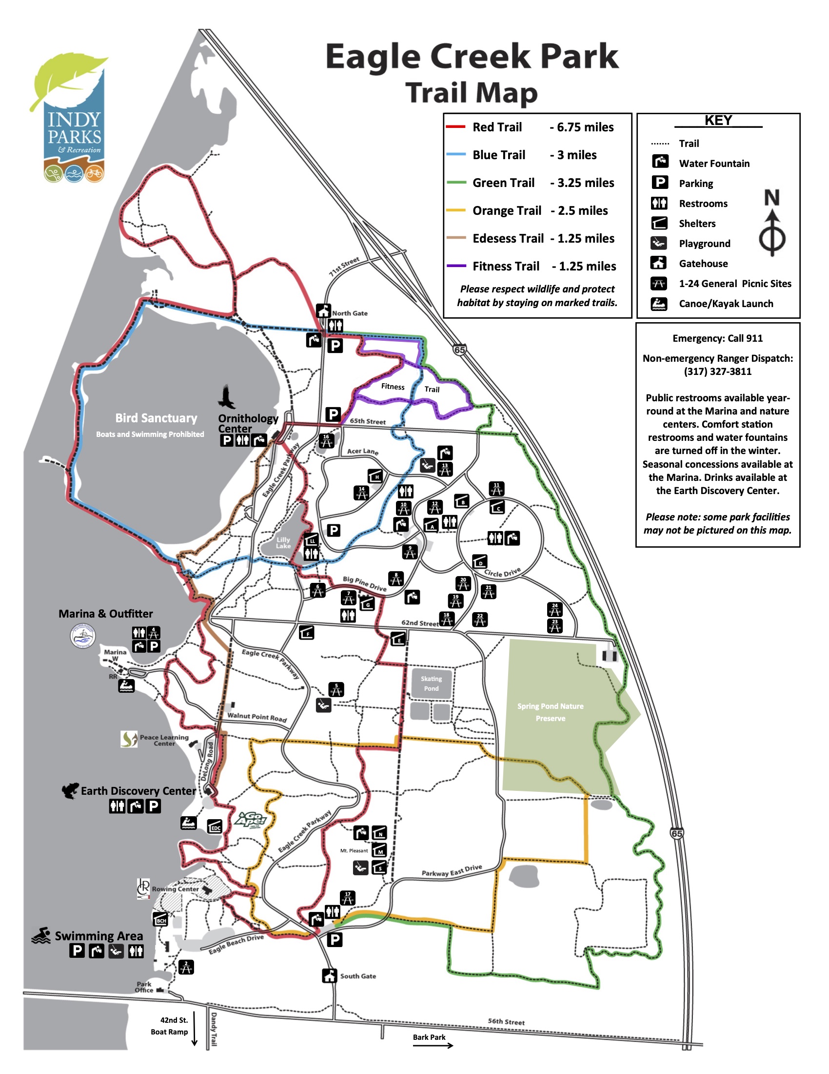
East Side Trails

The East Side of Eagle Creek Park contains the majority of the park trails, amenities, and both nature centers. The East Side can be thought of as the “main park”

Detailed trail map of Eagle Creek Park showing various trails, distances, and key features for outdoor activities.

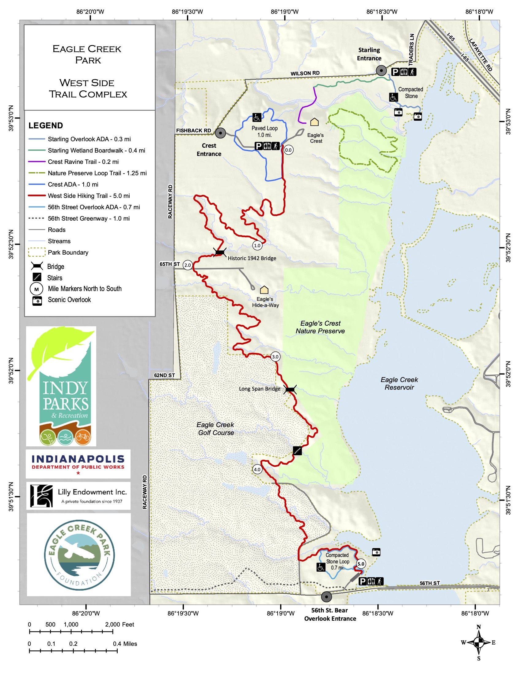
West Side Trails

The West Side Trail Complex was completed in 2024. The park’s West Side contains the Eagle Creek Golf Course, Eagle’s Crest Nature Preserve, and Starling Nature Preserve. Though less traveled, the West Side offers two ADA trails, a 5-mile through stunning canopy.

Map of Eagle Creek Park West Side Trail Complex, showing trails, entrances, and scenic overlooks in Indianapolis.

ADOPT A TRAIL

Your donation helps support Eagle Creek Park Foundation’s mission to Promote, Protect, Preserve and Enhance Eagle Creek Park!

Explore Top Hikes on

AllTrails logo featuring a mountain design in green, representing outdoor adventure and trail exploration.

ï•‹

Top Hikes East Side

Check out which trails All Trails users like most on the East Side of Eagle Creek Park.

A group of people walking along a nature trail surrounded by greenery and trees, enjoying the outdoors on a sunny day.
Waterfowl Sanctuary (Cofferdam) Loop

2.4 mi (easy)

Two hikers climbing wooden stairs in a lush green forest, showcasing outdoor fitness and nature activities.
Red Trail Loop

6.75 mi (moderate)



Top Hikes West Side

Check out which trails All Trails users like most on the West Side of Eagle Creek Park.

A serene scene featuring a white swan swimming in a lake with pelicans resting on the shore amidst lush greenery.
Scott Starling Nature Sanctuary

ADA accessible 0.6 mi (easy)

A Green Heron standing on a log in a wetland area surrounded by water and vegetation, showcasing its distinctive plumage and posture.
Scott Starling via Eagle’s Crest Loop

1.9 mi (easy)

DOWNLOAD TRAIL MAPS

Detailed trail map showing various routes including Blue, Green, Orange, Excess, and Fitness trails in a local sanctuary.

PARK TRAIL MAP

Detailed map and instructions for a 5K run event, featuring course layout and participant guidelines.

RUNNING COURSE MAP

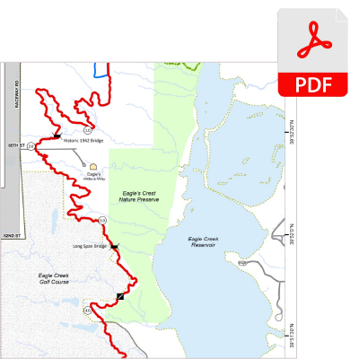
Detailed map of Eagle Creek Nature Preserve showing trails, landmarks, and water bodies for outdoor enthusiasts and nature lovers.

WEST SIDE HIKING TRAILS

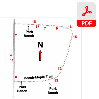
Detailed map showing Beech-Maple Trail and locations of park benches, with directional indicators and numbered points for navigation.

ORNITHOLOGY CENTER TREE MAP

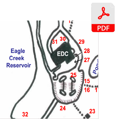
Detailed map of Eagle Creek Reservoir showing key locations and features, including EDC and numbered points for navigation.

EARTH DISCOVERY CENTER TRAILS

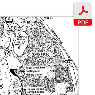
Detailed map of Eagle Creek Park showing waterfowl sanctuary, Lilly Lake, and boating areas, designed for outdoor navigation.

FISHING MAP

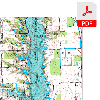
Topographic map showing detailed terrain features, water bodies, and elevation lines in PDF format for navigation and planning.

STATE NATURE PRESERVES

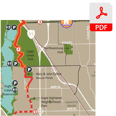
Detailed map of Eagle Creek Park and surrounding areas, including trails, parking, and points of interest in PDF format.

GREENWAYS MAP

DONATE

Your donation helps support Eagle Creek Park Foundation's mission to Promote, Protect, Preserve and Enhance Eagle Creek Park!